SR 17 Widening

FAST FACTS

GDOT Project #: 0013311
Type: Reconstruction/Rehabilitation
Project Length: 12.2 miles
Affected Counties: Wilkes, Ebert
Condemning Authority: GDOT
Estimated Affected Parcels: 240
Estimated Cost: $97,689,000
Right-of-Way Funds: $28,820,000

Description

A 12.2 miles stretch of State Route 17 is set to be widened by GDOT. The current two lane road will be widened to four travel lanes between Vinson Road in Wilkes County to Robinwood Lane in Elbert County, with bicycle and pedestrian infrastructure added. It will also add left turn lanes, and replace the bridge over Dry Fork Creek.

The roadway itself will expand significantly as a result, especially where central left turn lanes replace the planned four-foot flush median. The addition of bicycle lanes, extended sidewalks, and a minimum of 6’ of paved shoulder mean that the properties along the right-of-way may face significant eminent domain takings.

Business and homeowner concerns

Property owners along the 12.2-mile construction corridor stand to lose a significant amount of land to the project. GDOT will take what it needs for roads, sidewalks, bike lanes, and shoulder, along with temporary and permanent easements for things like construction, drainage, and possible utilities.

The result may be that properties can no longer be used the same way, or in the ways that owners want or plan to use them. Structures may no longer conform to county requirements. Homeowners may have traffic uncomfortably close, and may be in danger of losing things like septic tanks if the equipment is located on land being taken.

Business and commercial properties may face restricted customer access, depending on where GDOT places turning lanes, and could lose vital parking space, signage, and so on. The costs to businesses could be crippling.

What to do if your property is affected

Whether you own a business or commercial property, or your home is in the path of the SR 17 widening project, know your rights. The condemning authority can take your land, but you have the right to fair compensation. Their initial offer is just the beginning – as long as you do not accept it. You can fight for more. Call 1-888-391-1339 or contact us as soon as possible for a complimentary case evaluation.

We do not take an attorney’s fee unless we increase the government’s offer, and our fee only comes from the increased amount – our no fee guarantee. The initial offer is entirely yours regardless of what you do next or what we may be able to obtain. Further, we front the costs of fighting your case and if we’re unable to increase the government’s offer to you, you don’t pay them. We do. That is how confident we are that we can assist you.

Project maps

SR 17 Widening Map 1

SR 17 Widening Map 2

SR 17 Widening Map 3

SR 17 Widening Map 4

SR 17 Widening Map 5

SR 17 Widening Map 6

SR 17 Widening Map 7

Estimated project schedule

Right of Way Acquisition – 2023

Start Construction – 2024

End Construction – 2028

Affected parcels

An estimated 240 parcels of property will be affected by the SR 17 widening project in Wilkes and Elbert Counties. All of them may face significant loss of value, and many of those properties may lose significant amounts of their land. For homeowners and commercial property owners in the path of the project, it is critical to understand that the government’s initial offer is just that – initial. We do not recommend you accept the initial offer.

Get a free case
evaluation today.

There are only a handful of attorneys in GA who practice eminent domain exclusively. And even fewer with DOT experience. That’s why it’s always worth it to get a free case evaluation.

Here’s how it works:

1) Tell us about your situation.

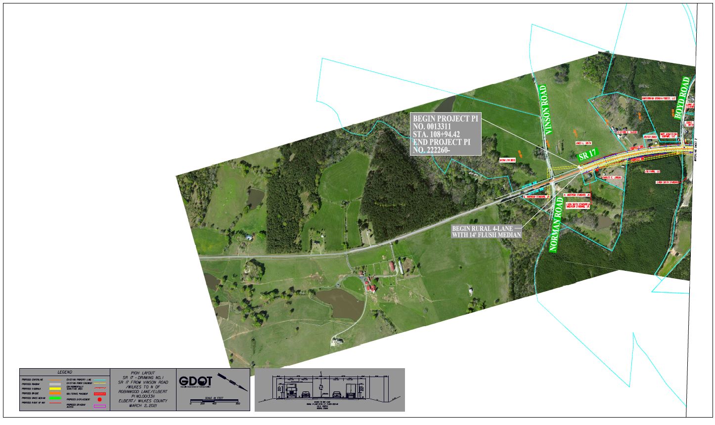
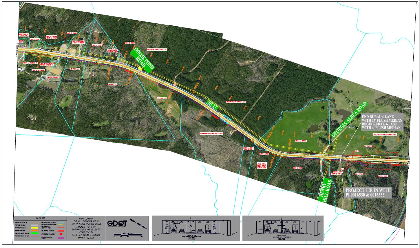
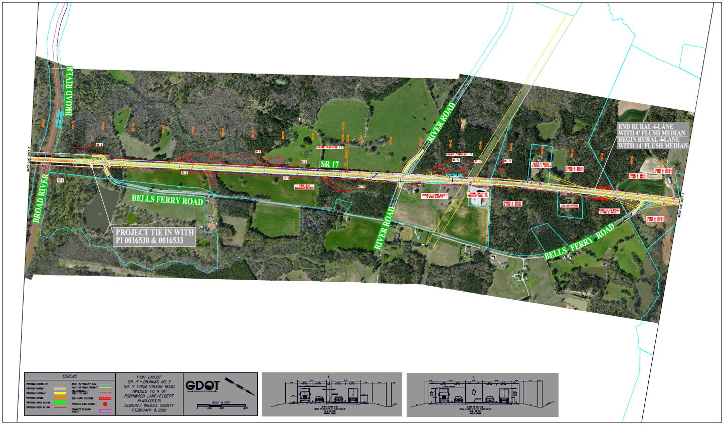
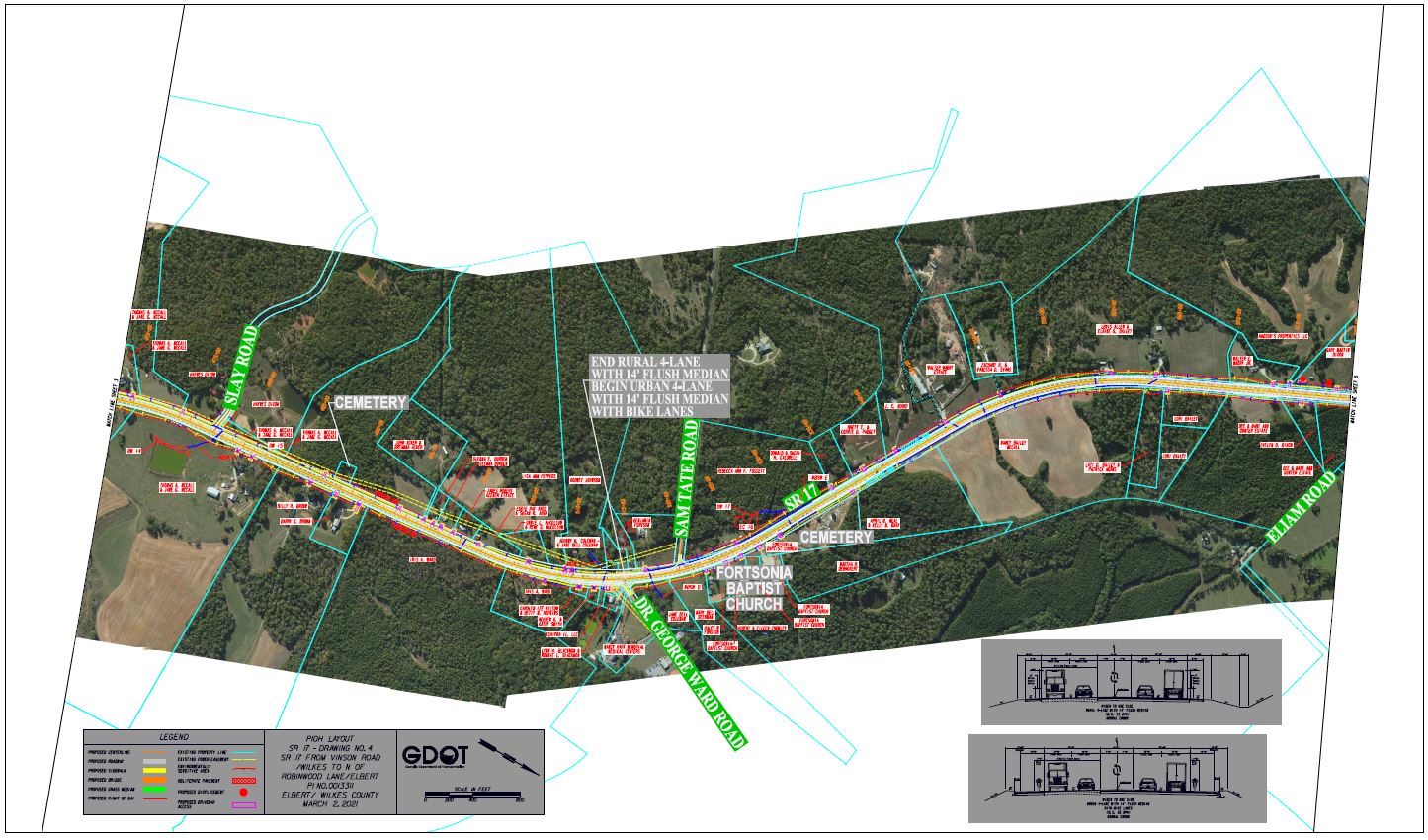
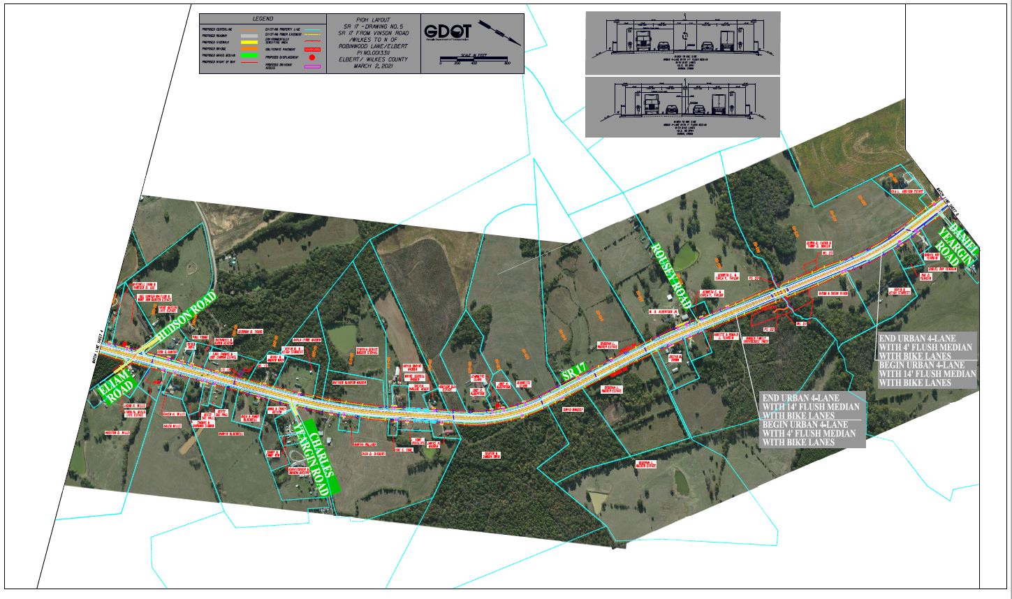
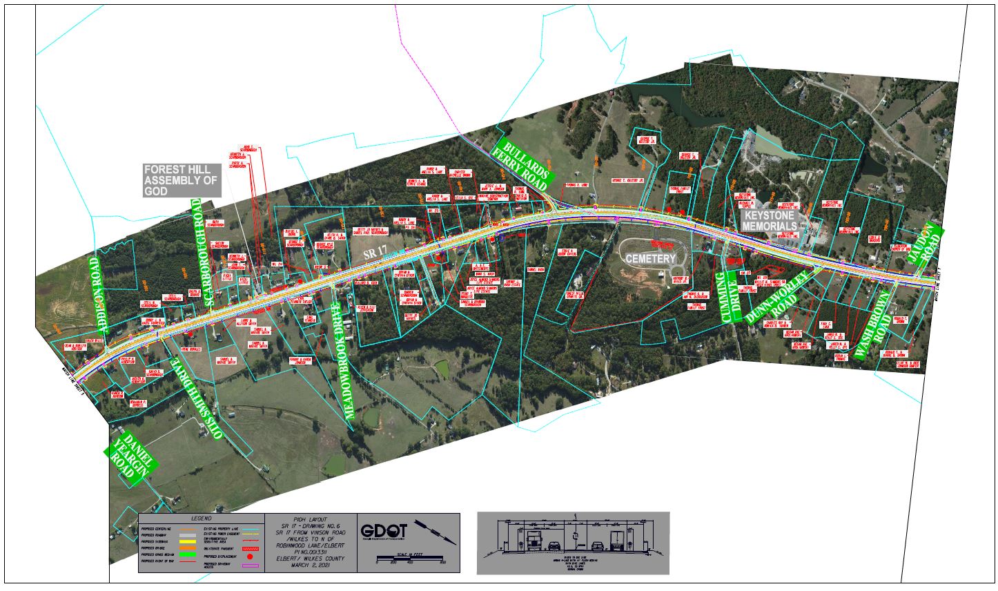
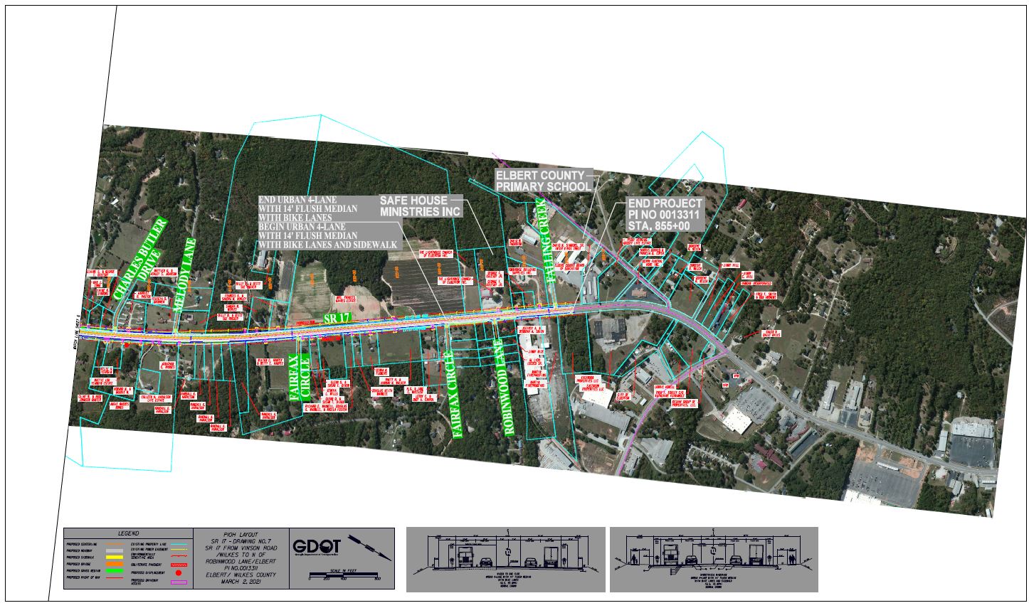
2) We research your property as needed, using DOT maps, our own technology, and experience to see the exact effects.

3) We let you know what we think a fair offer would be. This evaluation is free, and there’s no
pressure or obligation to hire us after.

But please don’t wait to act. Waiting can hurt your case, and the cost is the same: free.

"*" indicates required fields

This field is for validation purposes and should be left unchanged.