Sardis Road Connector

Fast Facts

GDOT Project #: 0003626
Type: Road Widening
Project Length: 3.55 miles
Affected Counties: Hall
Condemning Authority: Hall County
Estimated Affected Parcels: 141
Estimated Cost: $76,920,435
Right-of-Way Funds: $20,763,000

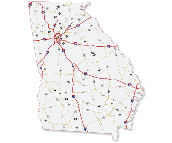
A map of Georgia, USA showing the main highways and interstate roads.

Description

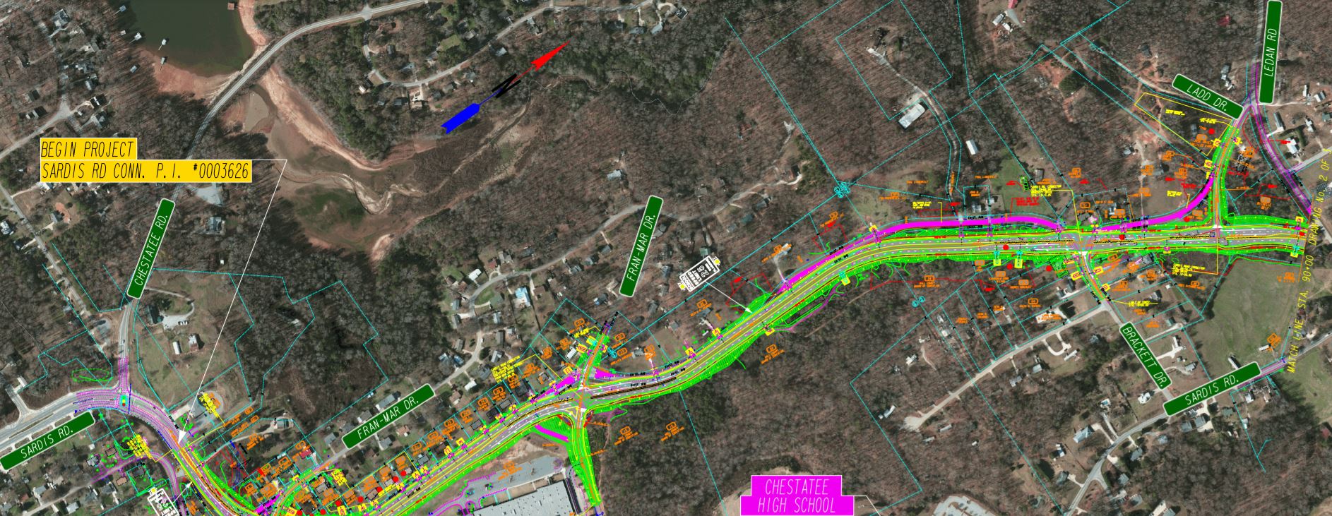
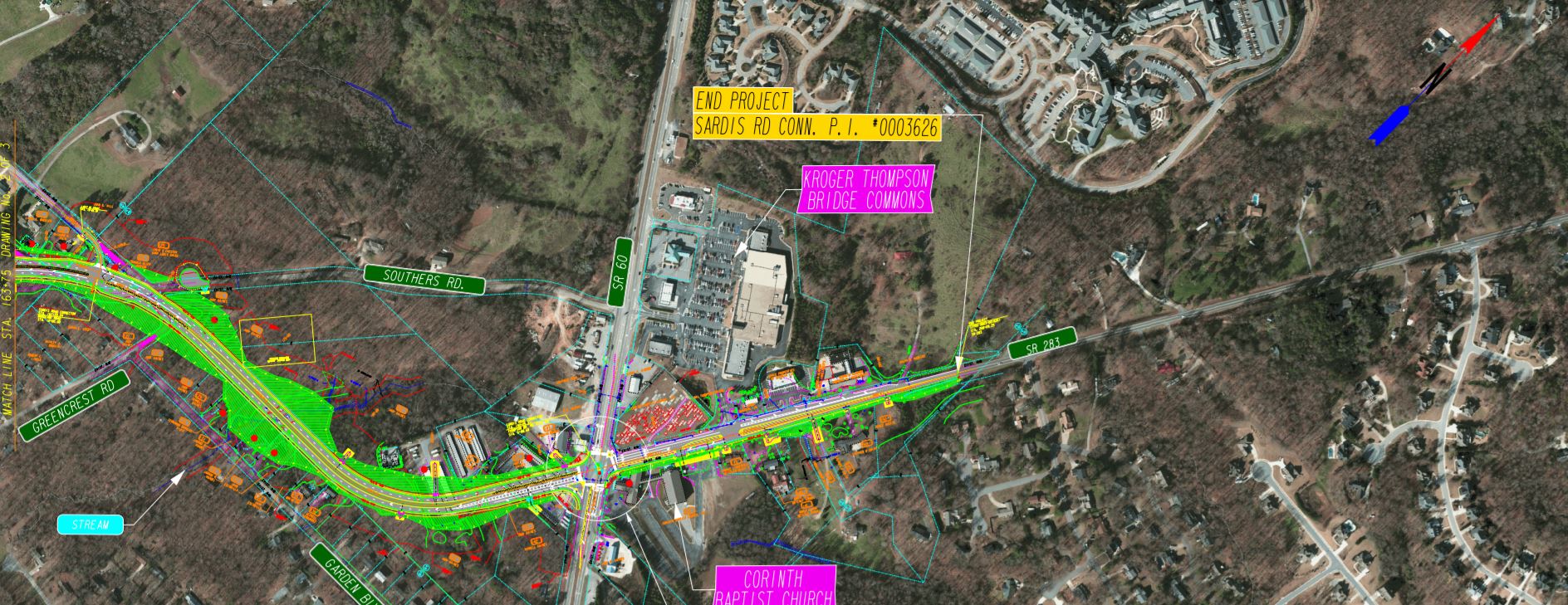
The Sardis Road Connector project consists of the widening and reconstruction of several existing local roads and streets with some new roadway on new alignment. Beginning at the Sardis Road/Chestatee Road intersection, construction will extend north to SR 60 to the intersection with Mt. Vernon Road.

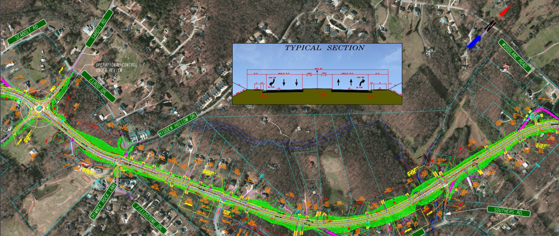
The project will follow some existing roads, but some of the roadway will be built in new locations requiring the taking of land from numerous parcels along the proposed route. The total project length is approximately 3.55 miles and will connect S.R. 53 to the south and S.R. 60 to the north with a four lane divided roadway, with a 20-foot wide median. Traffic flow, and especially left turns, will be made more difficult for businesses and residents alike, with direct cross-lane access impossible in some places.

Sidewalk will be constructed on both sides of the road, adding to the amount of land the government must take.

Business and homeowner concerns

Widening an existing road is usually invasive enough, but when the government decides to add new roads, it can cut a swath across properties, take whole parcels, or even cut a path through a parcel, splitting it in two.

In addition, the creation of a median and a sidewalk provides safety at the expense of property owners who must surrender land as the right-of-way widens. Medians also limit the ability of cross-travel, and may make it difficult for customers to access businesses, or for property owners to enter and exit.

Finally, there may be drainage and utility easements taken, and damage to property owners via inverse condemnation.

What to do if your property is affected

Whether you own a business or commercial property, or your home is in the path of the Sardis Road Connector, you have rights. The condemning authority has the right to take your land, but you have the right to fair compensation. The initial offer is just the beginning – as long as you do not accept it. You can fight for more. Call 1-888-391-1339 or contact us as soon as possible for a complimentary case evaluation.

We do not take an attorney’s fee unless we increase the government’s offer, and our fee only comes from the increased amount – our no fee guarantee. The initial offer is entirely yours regardless of what you do next or what we may be able to obtain. Further, we front the costs of fighting your case and if we’re unable to increase the government’s offer to you, you don’t pay them. We do. That is how confident we are that we can assist you.

Project maps

Sardis Connector Map Panel 1
Sardis Connector Map Panel 2
Sardis Connector Map Panel 3

Estimated project schedule

Right of Way Acquisition – 2021

Start Construction – 2022

End Construction – 2024

Affected parcels

An estimated 141 parcels of property will be affected by the Sardis Road Connector project in Hall County. About ten of those are commercial parcels, or will suffer a major impact. For homeowners and commercial property owners in the path of the project, it is critical to understand that the government’s initial offer is just that – initial. We do not recommend you accept the initial offer.


Get a free case
evaluation today.

There are only a handful of attorneys in GA who practice eminent domain exclusively. And even fewer with DOT experience. That’s why it’s always worth it to get a free case evaluation.

Here’s how it works:

1) Tell us about your situation.

2) We research your property as needed, using DOT maps, our own technology, and experience to see the exact effects.

3) We let you know what we think a fair offer would be. This evaluation is free, and there’s no
pressure or obligation to hire us after.

But please don’t wait to act. Waiting can hurt your case, and the cost is the same: free.
"*" indicates required fields

This field is for validation purposes and should be left unchanged.